Looking for your ancestors from the Netherlands? Yvette Hoitink is a professional genealogist in the Netherlands who does research throughout the country. Read about our services, fees, and example projects or read testimonials by clients like you.
If you want to learn more about researching Dutch ancestors, make sure to read the blog.

Map of the Week – Land Owners in Berghse Velt, 1727
This week we are looking at one map from an atlas of properties in the county of Bergh in Gelderland from 1727. The whole atlas is available at the website of the Erfgoedcentrum Achterhoek en Liemers. Such atlases often show the plots, which can help us locate our ancestor’s properties. Sometimes, the names of the […]
Dutch term – Openbaarheidsbeperking
Openbaarheidsbeperking means a limitation on the public availability; an access restriction. You may come across the term in finding aids or archival descriptions. Under the Archiefwet [Archive Law] of 1995, records created by the government are public, and access can only be restricted on three grounds: Privacy of living people, The interests of the real […]

Map of the week – Border between Rijnland, Utrecht, Amstelland, 1567
This week we are looking at a map showing the border between Rijnland, Utrecht, and Amstelland in 1567. It was a copy from The map is oriented with the north toward the left. Most of the map shows the border between Rijnland (in green) and the Sticht Utrecht (in yellow). These areas all had their […]
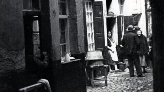
Dutch term – Slop
A slop is a slum, a neighborhood with low quality housing. In some cities, like The Hague, the word slop was used for a particular little type of slum, a small alley in between main streets, lined with cheap housing. During the 1800s, many cities grew dramatically. Factories offered jobs, and drew many people from […]

Map of the Week – Railroad Arnhem-Zwolle, 1857
This week we are looking at a map planning the railroad from Arnhem to Zwolle in 1857. The map shows the planned trajectory and stations. This map can be found in record group 4.WCA at the National Archives, which holds the records for the Department of Public Works and its predecessors 1814-1940. The record group […]
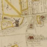
Map of the Week – Land Owners in Berghse Velt, 1727
This week we are looking at one map from an atlas of properties in the county of Bergh in Gelderland from 1727. The whole atlas is available at the website of the Erfgoedcentrum Achterhoek en Liemers. Such atlases often show the plots, which can help us locate our ancestor’s properties. Sometimes, the names of the […]