This week we are looking at a map showing the border between Rijnland, Utrecht, and Amstelland in 1567. It was a copy from The map is oriented with the north toward the left. Most of the map shows the border between Rijnland (in green) and the Sticht Utrecht (in yellow). These areas all had their own water boards, managing the dikes in their respective areas. The map shows the towns along the border, and indicates which polders belonged to which jurisdiction.
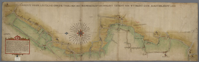
Border between Rijnland, Utrecht, and Amstelland, 1567. Credits: call no. A-0086, Hoogheemraadschap Rijnland (public domain)
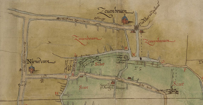
Detail showing Zevenhoven and Nieuwveen
Maps like this can help us figure out where the borders were at a particular time, which can help us determine who would have kept records about our ancestors. If our ancestors owned land in the polder marked Zevenhoven, the Utrecht water board may have taxed them for the maintenance of the dikes in the area. But if they owned land in the green part, we would look at the Rijnland records.

")