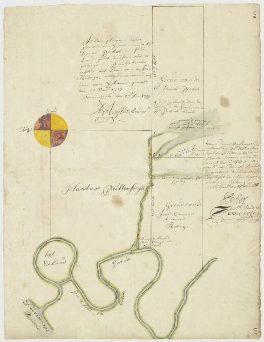
This 1719 map shows land owned by Daniel Pichot at the Paulus creek in Suriname.
Map of Daniel Pichot’s land, 1719. Credits: call no. 1797, collection 4.VEL, Nationaal Archief (public domain)
The map shows the location of a piece of land, large 1000 acres, at the Paulus creek, a tributary of the Suriname river. The land was surveyed on 25 November 1719 and the map was finished on 13 December 1719. The map showed the three places where the creek entered Pichot’s land, ending in a largee swamp. An “Indiaans Dorp” [Native American village” was located on the south-east of the property. The neighboring property belonged to a Jew called Gimenes, and formerly to a man named Rodrigo.
Like many owners of land or plantations in Suriname, Daniel Pichot was a merchant in Amsterdam. Map collections like that of the Nationaal Archief may reveal that our ancestors owned property in parts of the world where they did not live.

")