This week we are looking at an undated map from the early 1800s, showing all the overseas possessions claimed by the Netherlands at the time. Click the map to go to the full-size version at the website of the Nationaal Archief.
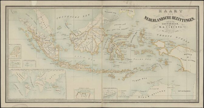
Map of overseas territories, early 1800s. Source: Call no. 776, Record Group 4.MIKO: Department of Colonies, Nationaal Archief, The Hague (public domain).
The Dutch East Indies (present-day Indonesia) formed the majority of the Dutch overseas possessions, outlined by ochre yellow. The Netherlands also claimed six islands in the West Indies, land between the Corantijn and Marowijne rivers in South America (present-day Suriname), and forts along the African coast (present-day Ghana).
On the left, we see the Netherlands at the same scale, emphasizing how vast the overseas lands were compared to the country that claimed these territories.

")