This week we are looking at the Topographic-Military Map of 1877, showing the area around Heusden.
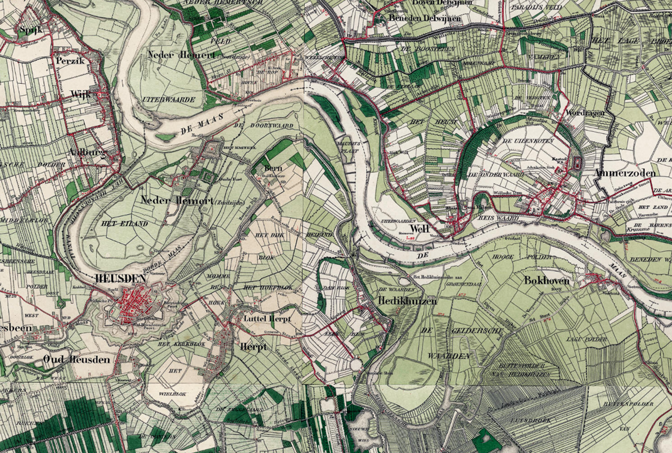
Map of Heusden, 1877. Credits: TopoTijdreis.
The map shows traces of the former runs of the river Meuse (“Maas” in Dutch) that meandered through the landscape. Heusden used to be on one bend of the river, before the river found a new course further north. It left behind a part of the bend, called “Doode Maas” [dead Meuse] on the map. If we study the map, we can see several traces of former river bends in the landscape.
The changing course of the river would have affected ancestors who lived in the area. Their lands and houses may have flooded, and after a breakthrough they may have suddenly found themselves living on the other side of the river, perhaps forcing them to attend a different church then they used to.
These topographical maps are available for the whole country since 1850 via TopoTijdreis.

")