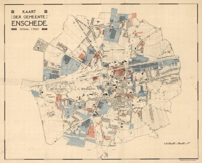
This week we’re looking at a map of factories and businesses in Enschede in 1930.
Map of Enschede, 1930. Credits: Stadsarchief Enschede (public domain).
Before 1839, the textile industry of the Netherlands was mostly concentrated in the southern Netherlands. When Belgium split off in 1839, this offered new opportunities for textile manufacturers in the (northern) Netherlands since import tarriffs made Belgian goods more expensive for Dutch consumers.
Enschede was one of the places where a flourishing textile industry developed after 1839. This map marks all the areas used for factories in blue. Most of these were textile factories. The factories attracted workers from a large area, including the Vollenhove area in western Overijssel, the province of Drenthe, and Germany. Maps like this help us understand the economy of a location and the migration patterns of our ancestors.

")
beautiful,
can I get the map in high resolution with explanation of the colours
You can click on the map for a larger version but I don’t think it has a legend.