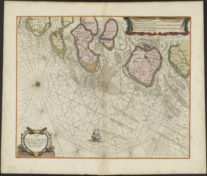
This week we are looking at a nautical chart made by Pieter Goos from an atlas published between 1666 and 1683. It shows the access routes to the South Holland and Zeeland rivers and cities.
Nautical chart, 1663-1683.
Credits: call no. MC615, Record Group 4.HEK, Collection Hans and Eva Kok, Nationaal Archief (public domain)
The chart was intended for sailors to set their course. It is oriented with the north on the left, as you can see in the compass. The different compass points allowed navigators to determine the headings to navigate the waters. The chart also showed the depths and channels to take to safely make it to the harbors of Brielle, Goeree, Brouwershaven, Zierikzee, Middelburg, Vlissingen, and Veere.
The map shows how narrow some of these channels were, and the many shallow parts in between. If you have sea-faring ancestors from Zeeland or Holland, maps like this make it easy to understand why not everybody made it home alive.

")