Map of the Week – Schermer land reclamation, 1635

This map shows the Scher-meer [Scher lake, also called Schermermeer], a lake that was drained between 1633 and 1635 to claim land. The map shows how this was done: a dike and ditch were built around the lake. Mills would pump water out of the lake, across the dike, into the surrounding ditch, from where it was carried to rivers and ultimately to the sea. Smaller ditches would criss-cross the lake to drain the land. The mills had to continously pump or the lake would fill up again.

The Dutch have been reclaiming land from the sea or lakes since the Middle Ages, but it was not until the 1600s that this was done on an industrial scale like we see on this map of the Schermer.

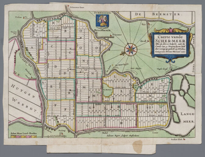
Map of the Schermer, 1635. Credits: Pieter Wils, collection Regionaal Archief Alkmaar (public domain)

About Yvette Hoitink

Yvette Hoitink, MLitt, CG®, QG™ is a professional genealogist, writer, and lecturer in the Netherlands. She has a Master of Letters in Family and Local History from the University of Dundee, and holds the Certification of Genealogist and Qualified Genealogist credentials. Yvette served on the Board of Directors of the Association of Professional Genealogists and won excellence awards for her articles in the National Genealogical Society Quarterly and the Association of Professional Genealogists Quarterly. Yvette has been doing genealogy for over 30 years. She helps people from across the world find their ancestors from the Netherlands and its former colonies, including New Netherland. Read about Yvette's professional genealogy services.

Leave comment

*