This week’s map dates from World War I and is part of a larger series showing military activity. This particular map shows the activity until 7 October 1914.
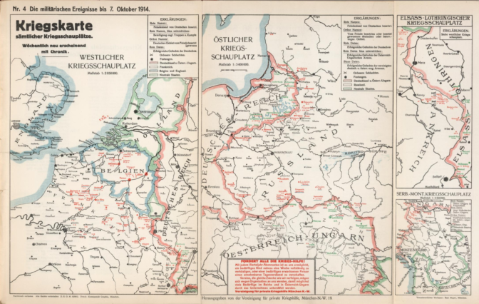
World War I map. Credits: Rudolf Maayer, 1915, via David Rumsey Map Collection (public domain)
The Netherlands was neutral during World War I, as shown by the green color on the map. The map shows how close the activity got, with a sunken U-boat off the coast of Scheveningen, and various battles just across the border in Belgium.
Although the Netherlands did not participate in the war, it did affect the lives of Dutch people. Imports and exports ground to a halt, leading to many shortages. Belgian refugees crossed the border and were found places to stay. People who needed to travel overseas faced a hazordous journey, as civilian ships were sometimes targeted if they were mistaken for enemy vessels.

")