
In 1659, the famous mapmaker Joan Blaeu published his world atlas Tooneel des Aardrycks [Display of the Realm of Earth]. The archives in Leiden have made their atlas available online. This week we are looking at Blaeu's map of the province of Utrecht. The map shows that its largest city was the same-named Utrecht. The map shows a great difference in geography in the east and west of the province. The east is higher, with more woods. The lower land in the west has been drained and turned into … [Read more...]
Map of the Week – Connections in Utrecht, circa 1919
14 October 2024 by Leave a Comment

This map, created shortly after the end of World War I, shows the different connections in the province of Utrecht The legend identifies the different types of lines on the map: railroads tramways paved roads gravel roads provincial border dikes hills. The 1800s saw a tremendous increase in infrastructure. This map captures the rail and tram infrastructure at its height. In the course of the 1900s, many rail and tram lines were abolished as cars and transport by road … [Read more...]
Utrecht
10 May 2005 by 8 Comments
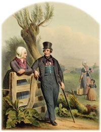
Utrecht is a province in the middle of the Netherlands. It borders on Gelderland in the east, Gelderland and Zuid-Holland in the south, Zuid-Holland and Noord-Holland in the west and Noord-Holland and Flevoland in the north. The capital city of Utrecht is called Utrecht as well. Other larger towns are: Amersfoort Zeist Soest Nieuwegein … [Read more...]

")