A trein is a train. The first railroad in the Netherlands was opened in 1839, between Amsterdam and Haarlem. Other railroads quickly followed and by the end of the 1800s, passenger travel by rail had supplanted travel by barge. Many emigrants leaving through the ports of Rotterdam, Amsterdam, or Antwerp took the train to the harbor.
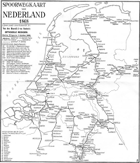
Railroad Map of the Netherlands, 1868 (public domain)

")
Is there a link to find these maps online?
I found this particular map on Wikimedia. I don’t know of any websites specializing in Dutch railroad maps.