This map of Holland appeared in an English atlas in 1832. This is two years after the Southern Netherlands split off to found the independent country of Belgium in 1830, but seven years before the Dutch government acknowledged the loss of these provinces and recognized Belgium as an independent country in 1839. In other words, we can see from the territory on the map that this 1832 map was not created in the Netherlands, since then it would have had the southern provinces too.
The map shows ten provinces. The current province of Limburg in the Netherlands was only formed after negotiations between Belgium and Netherlands. The Netherlands insisted on keeping some coal mines including river access, which led to the formation of the province of Limburg.
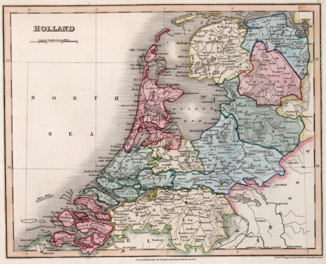
Holland in 1832. Credits: John Dower and W.M. Higgins, A General Descriptive Atlas Of The Earth, Containing Separate Maps Of The Various Countries And States, From Original Drawings (London, 1832), via David Rumsey Map Collection (public domain)

")