Map of the Week: Minute Map of Bredevoort, 1832

When the cadastral administration was introduced in 1832, maps were made of the entire country. Each municipality was divided into sections. All the plots in a section were mapped in one or more sheets. The map we see today is for Bredevoort, a fortified town in Gelderland. You can find the minute maps for the whole country at the Cultural Heritage Service website or you can read more about cadastral overview maps and minute maps.

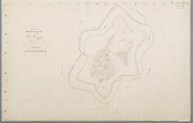
Bredevoort, minute map section B sheet 1, 1832. Credits: Rijksdienst voor het Cultureel Erfgoed, object MIN05028B01

About Yvette Hoitink

Yvette Hoitink, MLitt, CG®, QG™ is a professional genealogist, writer, and lecturer in the Netherlands. She has a Master of Letters in Family and Local History from the University of Dundee, and holds the Certification of Genealogist and Qualified Genealogist credentials. Yvette served on the Board of Directors of the Association of Professional Genealogists and won excellence awards for her articles in the National Genealogical Society Quarterly and the Association of Professional Genealogists Quarterly. Yvette has been doing genealogy for over 30 years. She helps people from across the world find their ancestors from the Netherlands and its former colonies, including New Netherland. Read about Yvette's professional genealogy services.

Trackbacks

  1. […] Map of the Week: Minute Map of Bredevoort, 1832 by Yvette Hoitink on Dutch Genealogy […]

Leave comment

*