Wars often lead to the creation of maps. This week we are looking at a map of the siege of Breda in 1624-1625. The map shows how Breda had been surrounded by a line, just outside the reach of the city’s canon. This allowed the attackers to cut supply lines while they besieged the city.
This map is of personal interest to me since several of my ancestors lived in this area. One of them had his land confiscated during the siege to build the bank and ditch and fortlets around Breda. Read more about how the Eighty Years’ War affected our ancestors’ lives.
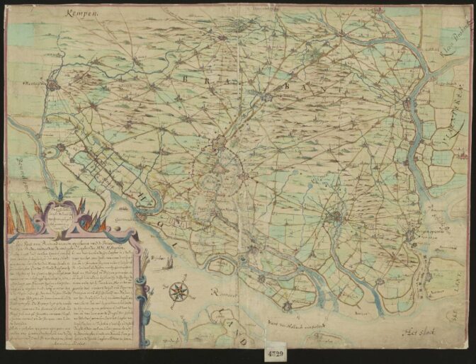
Map of the siege of Breda, 1624-1625. Credits: call no. 4239, record group 4.VTHR, Nationaal Archief, The Hague (public domain)

")