In this new series we will look at a different map every week. We kick off the series with a beautiful manuscript map of the island of Texel from 1645. Many ships departing to New Netherland or other Dutch colonies would lie on the roads of Texel to take in fresh water and wait for favorable winds before crossing the ocean.
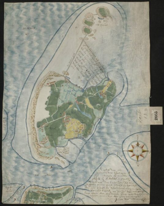
Map of the island of Texel and Eierland, by Johan van Teylingen, circa 1645, after an original by Adriaan Metius.
Credits: call no. 2665A, Record Group 4.VTH, Nationaal Archief, The Hague (public domain)

")
The map of the Island of Texel and Elerland is beautiful. Thank you for posting this, Yvette.