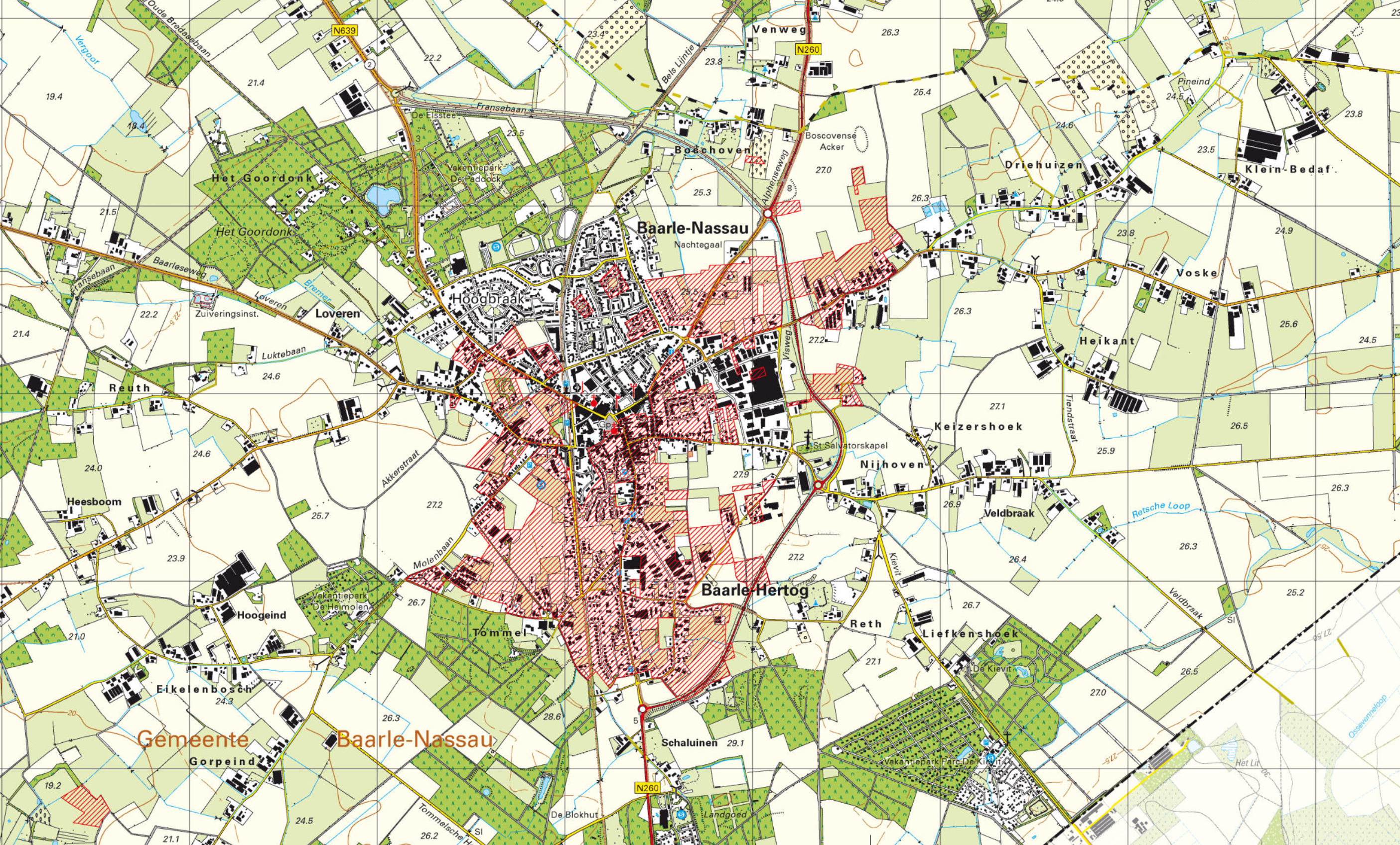
Topographical map of Baarle-Nassau and Baarle-Hertog, 2020. Credits: Topotijdreis (public domain)
If you look at a modern map of Baarle-Nassau in Noord-Brabant, you will see something weird. Lots of areas are marked in red. These areas are not part of Baarle-Nassau, but of Baarle-Hertog, a municipality in Belgium. There are little bits of Belgium in the Netherlands part, and little bits of the Netherlands in the Belgian part. In total, there are 30 enclaves (territory surrounded by another nation’s territory), of which 22 belong to Belgium’s Baarle-Hertog (H on the map below) and 8 belong to the Dutch Baarle-Nassau (N on the map below).
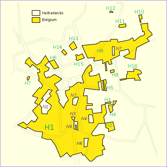
Overview of the border. Credits: Tos, Wikimedia Commons (public domain)
The complex border situation dates back to medieval treaties, where the Duke of Brabant gave land to the vassals but kept other parts to himself. The borders were fixed by the treaty of Maastricht in 1843.
The border is marked on the streets. Sometimes the border even runs through houses. I once heard an anecdote that an innkeeper couldn’t get a liquor license and removed the door to the other side of the house to apply to the other government, but that may be an urban myth.
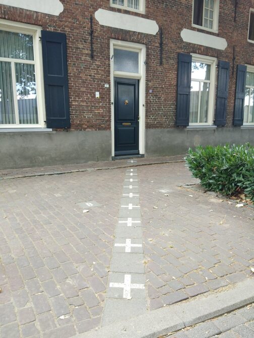
House on the border between Baarle-Hertog and Baarle-Nassau. Credits: Jack Soley, Wikimedia Commons (CC-BY-SA 3.0)
Sources
- Baarle-Nassau (Wikipedia)
- Het Grenzendoolhof van Baarle-Nassau en Baarle-Hertog (IsGeschiedenis)

")