I love old maps. They give a snapshot of what the area looked like where my ancestor lived and are great illustrations for publications about my ancestors. Here are some of my favorite places to find old maps.
City Atlas of Braun and Hogenberg, 1572
The City Atlas of Braun and Hogenberg covers cities in all of Europe. The 1572 atlas is available via the Utrecht University Library website.
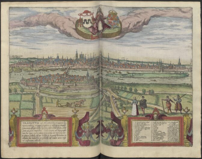
Maastricht in 1572. Credits: Braun & Hogenberg (public domain)
Blaeu atlas 1649
The Blaeu atlas from 1649 has maps of each region in the Netherlands.
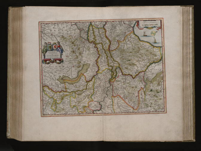
Blaeu map of Gelderland, 1649 (public domain)
Stedenatlas Frederik de Wit 1698
This stedenatlas [city atlas] by Frederik de Wit has maps of the most important cities of the Netherlands in 1698. Scans are availble via Wikimedia Commons or the Royal Library of the Netherlands.
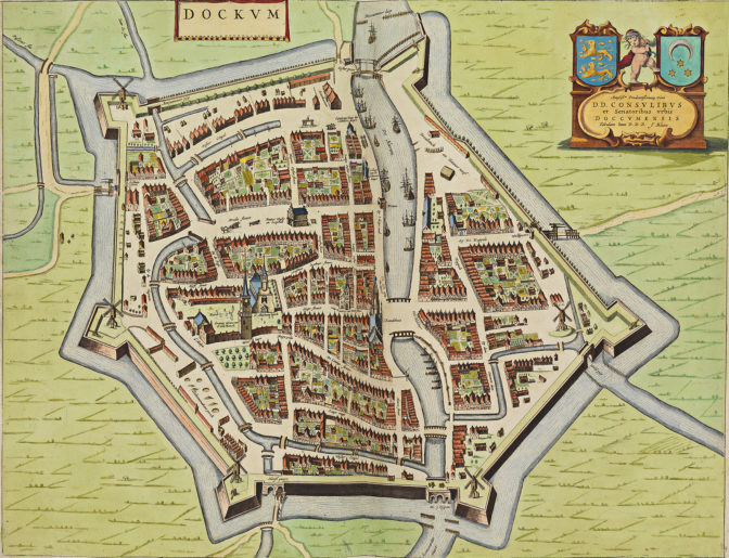
Map of Dokkum, 1698. Credits: Frederik de Wit (public domain)
Atlas Schoemaker (1710-1735)
This atlas is a series of topographical drawings made by Andries and Gerrit Schoemaker in the 1700s, often based on earlier depictions. Available via Geheugen, a part of Delpher.
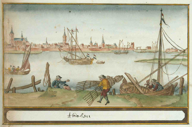
Fishermen in front of Tholen harbor. Credits: Atlas Schoemaker, collection Geheugen van Nederland (public domain)
Cadastral overview and minute maps (1832)
Cadastral overview and minute maps are available via the image bank of the Cultural Heritage Service. See the article about overview and minute maps for more explanation.
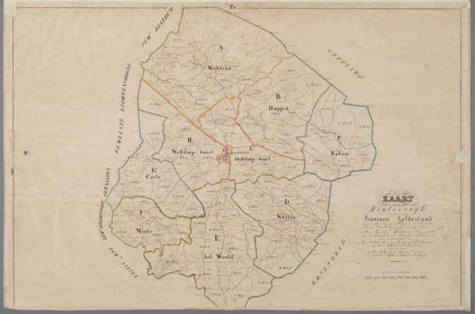
Overview map of Winterswijk, 1832
Topotijdreis (1815-present)
Topotijdreis lets you zoom into any part of the Netherlands and then see maps from 1815 to now. You can move the slider to change the date. Zooming in and out gives you maps of different scales.
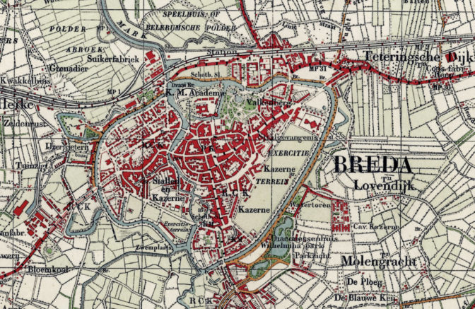
Breda in 1932. Credits: Topotijdreis (public domain)
Atlas 1868
The Kuyper atlas of 1868 has maps of each municipality in the Netherlands. Scans are available via Wikimedia Commons, Atlas 1868 or by doing a Google search for Kuyper plus the name of the municipality.
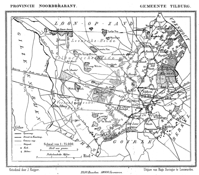
Tilburg in 1865. Credits: J. Kuyper, via Wikimedia Commons (public domain)
National Archives
The website of the National Archives of the Netherlands has a Kaarten [maps] section with lots of map collections:
- Johannes Vingboons, a mapmaker who worked for the Dutch East India Company
- Maps of polders [reclaimed land]
- Various maps of Zuid-Holland
- City plans from the 1500s by Jacob van Deventer.
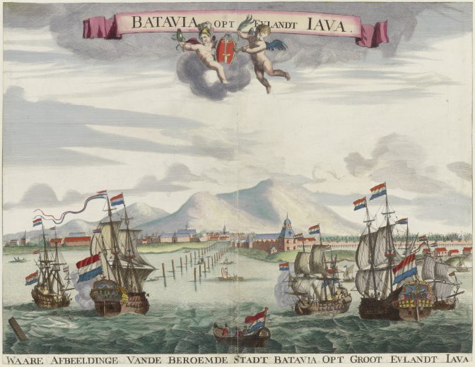
View of Batavia, 1665. Credits: Johannes Vingboons, collection Nationaal Archief
Atlas of Mutual Heritage
The Atlas of Mutual Heritage has maps related to Dutch colonial and trade relations.
Archieven.nl
Several archives publish their image collections, including maps, on Archieven.nl.
David Rumsey Map Collection
The David Rumsey Map Collection has maps from all over the world, including the Netherlands. I have found some great Dutch maps here by searching for the name of a town or province.

")
Yvette, thank you for this great collection of maps.
Wonderful maps, I also love maps. to think of my elders knowing the towns. My grand mouther was a Buwalda many people from Dokkum. Thank you for all you post! Larry Toom