Map of the Week – Groningen, 1659

In 1659, the famous mapmaker Joan Blaeu published his world atlas Tooneel des Aardrycks [Display of the Realm of Earth]. The archives in Leiden have made their atlas available online.

This week we are looking at Blaeu’s map of  the province of Groningen. It shows its largest city as the same-named Groningen (“Gronningen” on the map), connected to the North Sea by the Reitdiep. The map shows the roads and rivers that connected the smaller towns. See the research guide for Groningen for more information.

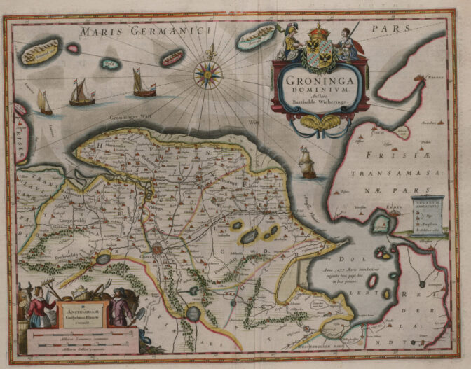
Province of Groningen, 1659. Credits: Joan Blaeu, imaged at Erfgoed Leiden (public domain)

About Yvette Hoitink

Yvette Hoitink, MLitt, CG®, QG™ is a professional genealogist, writer, and lecturer in the Netherlands. She has a Master of Letters in Family and Local History from the University of Dundee, and holds the Certification of Genealogist and Qualified Genealogist credentials. Yvette served on the Board of Directors of the Association of Professional Genealogists and won excellence awards for her articles in the National Genealogical Society Quarterly and the Association of Professional Genealogists Quarterly. Yvette has been doing genealogy for over 30 years. She helps people from across the world find their ancestors from the Netherlands and its former colonies, including New Netherland. Read about Yvette's professional genealogy services.

Leave comment

*